User manual
Map selector
The Map selector tool is found on the map window and is used to select different maps to view in the map window. You can also fade between different maps, which can be useful to compare a historic and contemporary map.
Select a different map
The Map selector button will be green when map selection is possible.
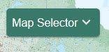
- To see what maps are available, select the Map Selector button to open the menu.
- To switch to a different map, select the button to the right of the map name.
- For example in the image below, Aerial mapping will be displayed as the button to the right is selected.
- Your selected map will be generated in the map window.
- Historic maps (1890s–1910s) are available with national coverage at approximately 1:10,000 scale. Use the Feature Info button to view the survey and publication dates for each sheet. Dates vary by sheet. The survey date shows when any part of the sheet was last updated, while the publication date shows when the sheet was last published. Adjacent sheets may have very different dates. This variation is normal for historical datasets.
Fade between maps
Use this to compare two maps.
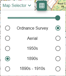
- Select the Map Selector button to open the menu.
- Select the 2 maps you want to compare – in the image below, we have selected Ordnance Survey on the right and Aerial on the left.
- Now drag the slider bar to the left in stages.
- As you move the slider bar in stages, the two maps will be displayed on top of each other.
- When the slider bar is fully left, only Aerial will be displayed.
- When the slider bar is fully right, only Ordnance Survey mapping will be displayed.
Maps of Great Britain
When over Great Britain, the Map Selector is available in the 8 most detailed scales.
- Ordnance Survey - contemporary maps of Great Britain. There is always an Ordnance Survey map available - the map on display will vary, depending on your scale.
- Aerial - aerial photography of Great Britain, available at 8 scales.
- 1950s - available at 5 scales.
- 1890s - available at 5 scales.
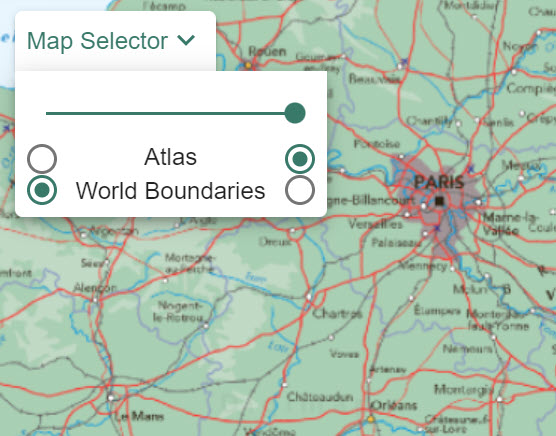
World maps
When looking at maps beyond Great Britain, the Map Selector is available for the 12 least detailed scales. The options in these scales are:
- Atlas - displays World Panorama political and terrain mapping - this is displayed in the image below.
- World Boundaries - displays Natural Earth mapping which shows country boundaries and place names in the Roman alphabet.
Detailed Country maps
OpenStreetMap is displayed at more detailed scales (beyond GB) and the Map Selector button is unavailable. Place names may be displayed in the country’s native character sets e.g. Chinese or Cyrillic characters.
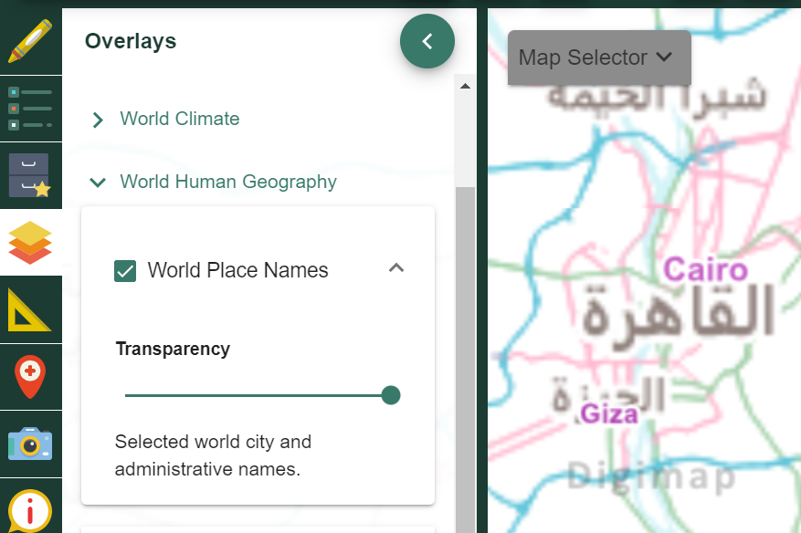
To display World Place Names in Roman characters:
- Select Overlays from the sidebar.
- Select World Human Geography.
- Select World Place Names - shown in the image below.