

User manual
Print maps
You can create A3 and A4 printable maps with our print tool. Legends are optional and provided as a separate PDF file.
Create your print file
- Select the Print tool from the top toolbar.
- Input a Map Title (optional).
- Input your name or other identifier (optional).
- Select whether you want the exact scale shown on the screen or the nearest rounded scale.
- Select PDF or JPG as format - note both formats look exactly the same.
- Select A4 or A3.
- Select Portrait or Landscape.
- Optional additions:
- Drawings - add your drawings to the print file.
- National Grid Lines - add British National Grid Lines.
- Legend - add a separate PDF legend file.
- Select Generate Print File.

Preview map
The print window will show a preview of your printed map, including the extent. You can change the area your printed map will cover by moving the map to a new position using your mouse or touch screen.
Please note that the preview may not show everything that appears on your map. Some aspects may differ slightly owing to differences in the way print maps and screen maps are generated.
Open and print your file
- Find your PDF or JPG file - the location will vary depending on your device’s setup.
- If you selected Add Legend, you will receive a zip file. This wil have 2 files in it - the print file and the legend file.
- Select either file to open.
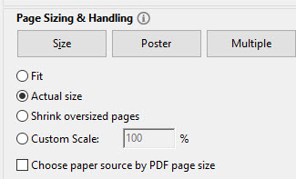
- NOTE: when you print your map, ensure your print settings say Actual size to maintain scale.
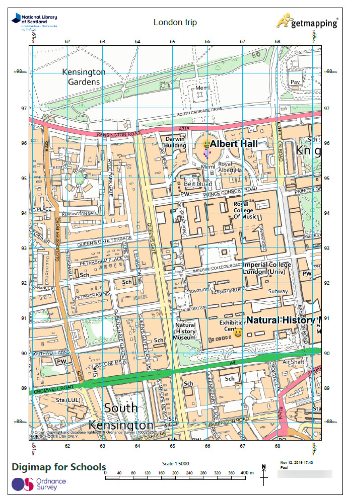
Print file example
Here’s an image of an A4 portrait print file:
Watch the video
Watch the short video below for a demo of the print tool.