User manual
Overlays
Table of Contents
- Viewing overlays
- GB overlays
- World Climate
- World Human Geography
- World Physical Geography
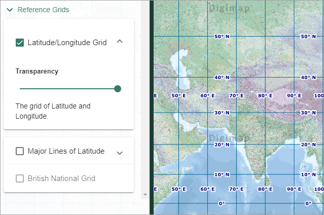
- Reference Grids
The Overlays menu in the sidebar allows you to view additional geographic information on your map.
Viewing overlays
- Open the Overlays menu in the sidebar.
- Select a category to view the available overlays.
- Check the box next to any overlay you wish to view.
- NOTE: You can view more than one overlay at the same time.
- NOTE: If the overlay checkbox is greyed out, you need to zoom in/out to view the overlay.
- The overlay is displayed in the map window.
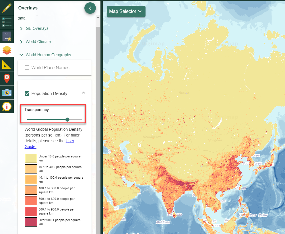
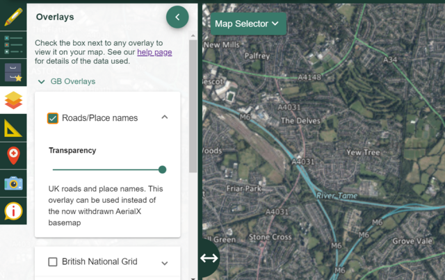
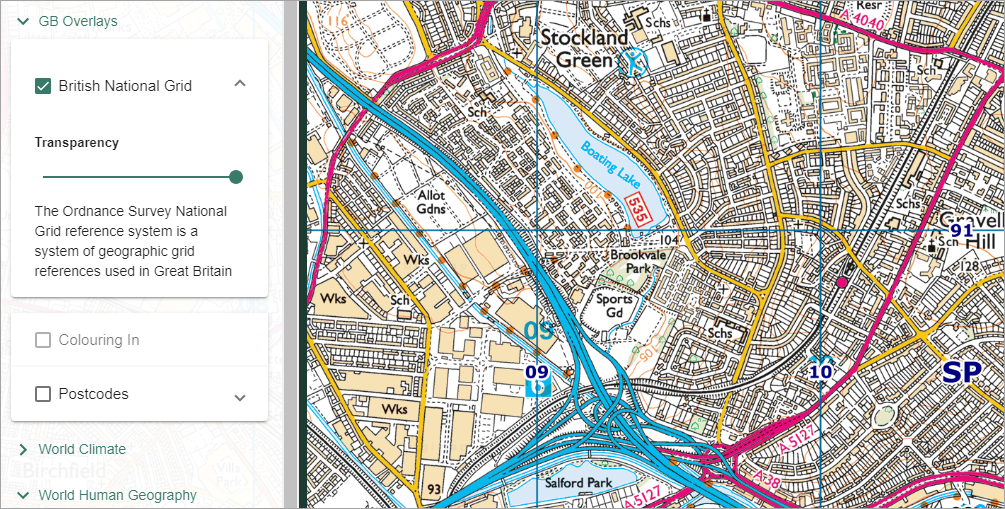
- Adjust the transparency of the overlay by moving the transparency slider (highlighted in image below) left and right.
GB overlays
Only available over Great Britain.
Road/place names
Ideal to use with our Aerial mapping to give context.
British National Grid lines
Grid lines will become progressively more detailed as you zoom in.
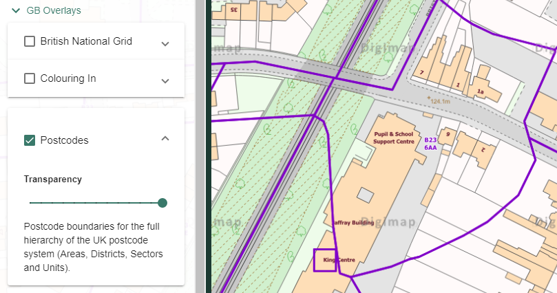
British postcodes
Our postcode data becomes progressively more detailed as you zoom in.
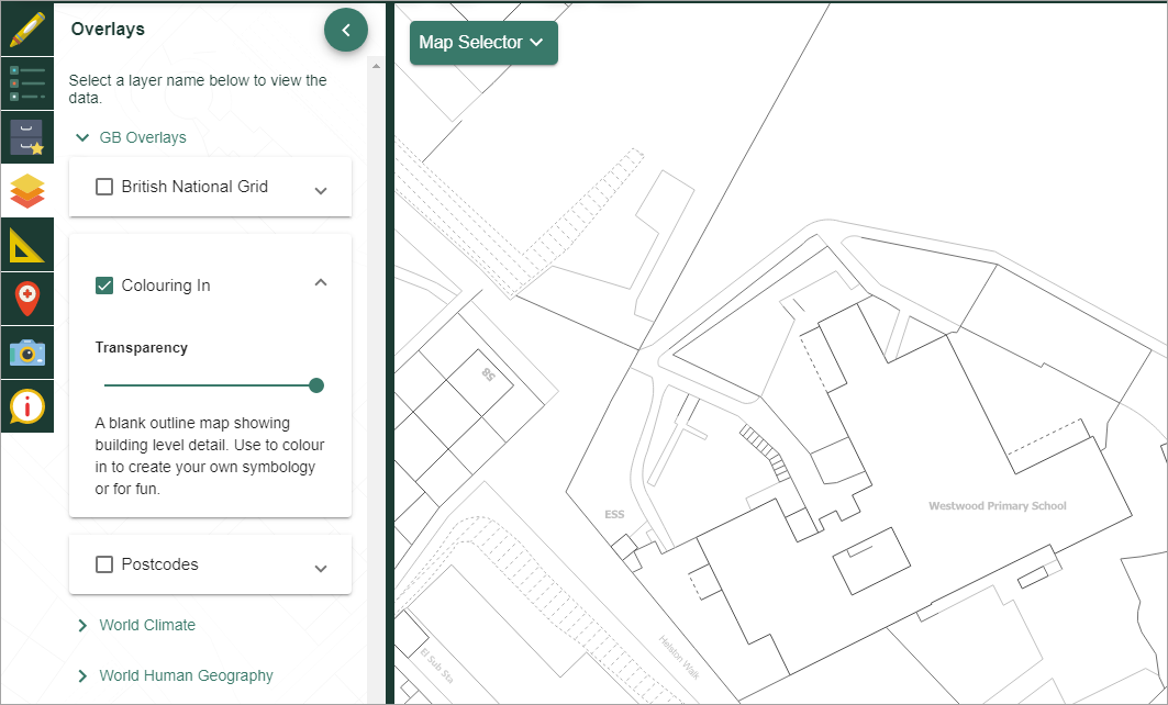
Colouring in
Only available at more detailed scales where OS MasterMap® data is displayed. A blank map that can be used to colour in/create your own map key.
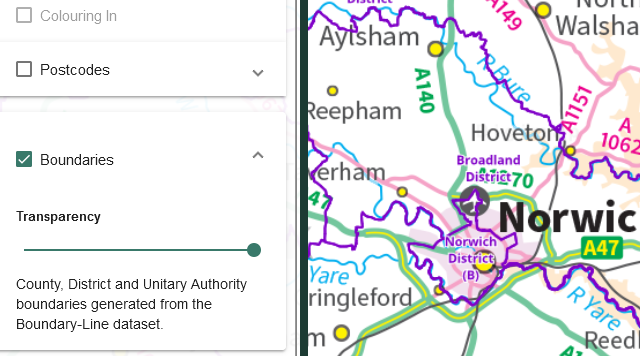
Boundaries
County, District and Unitary Authority boundaries generated from Ordnance Survey’s Boundary-Line dataset. Available at smaller scales.
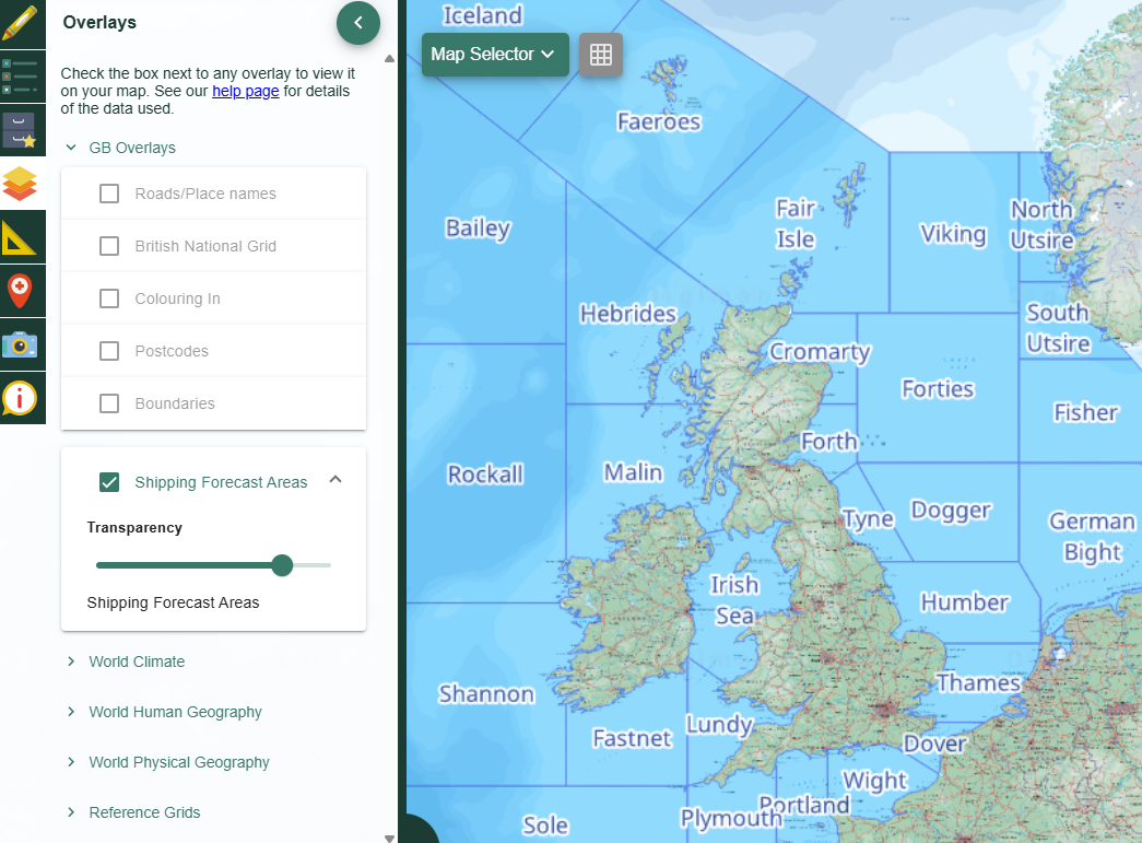
Shipping Forecast Areas
The Shipping Forecast areas comprise 31 maritime zones surrounding the UK and Ireland, named after distinctive geographical features or prominent maritime figures (e.g. Fitzroy). Essential for maritime safety.
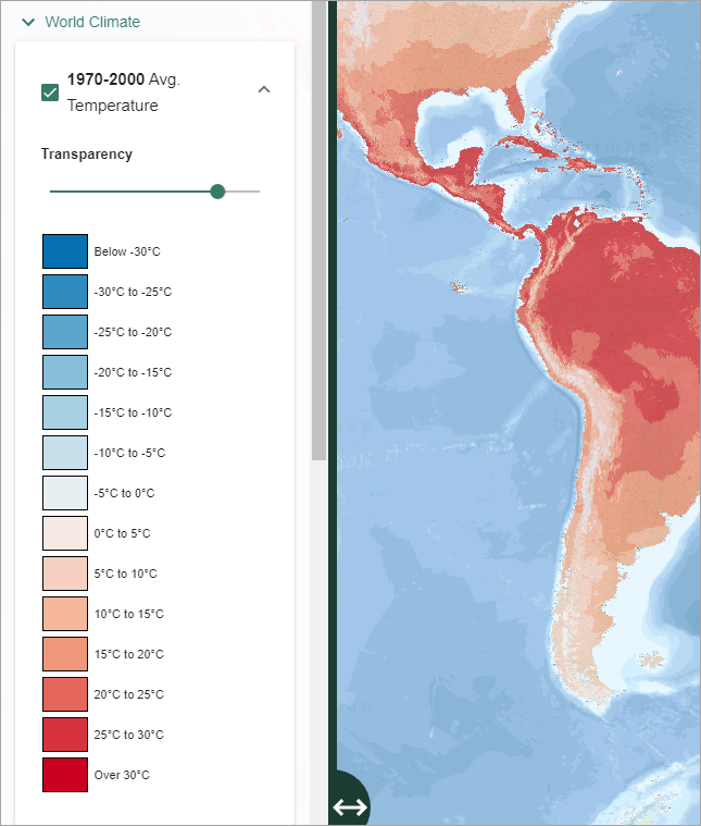
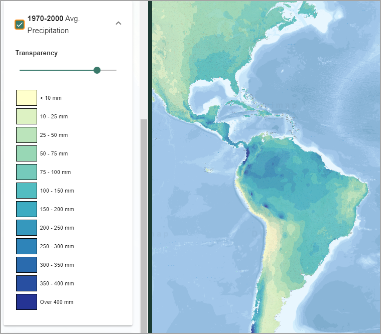
World Climate
Temperature
- Historical and projected temperature information is available.
- Details of the data can be found in our guide.
Precipitation
- Historical and projected precipitation information is available.
- Details of the data can be found in our guide.
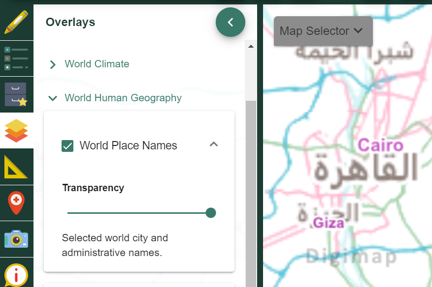
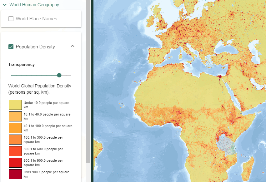
World Human Geography
World Place Names
This overlay is helpful in locations where the map displays place names in non-Roman characters, such as Asia.
Population Density
- Visualise population per square kilometre.
- Details of the data can be found in our guide.
Please NOTE: census data are not always available in every country nor is collection temporally continuous.
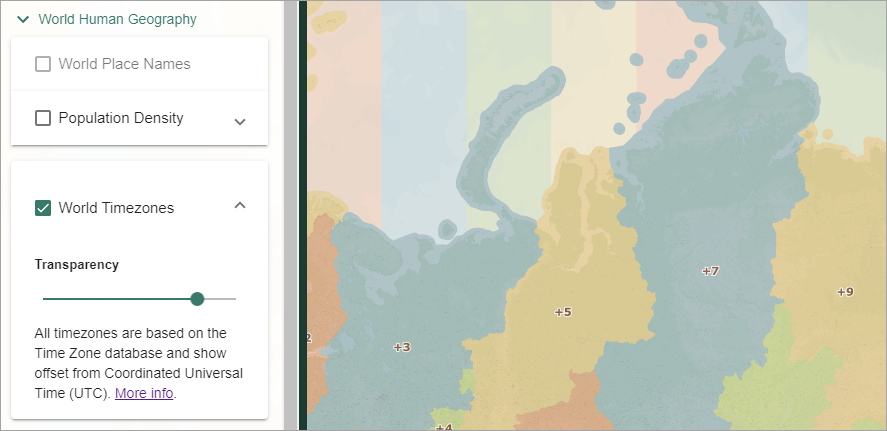
World Timezones
All timezones are based on the Time Zone database and show offset from Coordinated Universal Time (UTC) - more information.
World Physical Geography
There are five overlays available, including biomes, volcanoes, mountain ranges and tectonic plates.
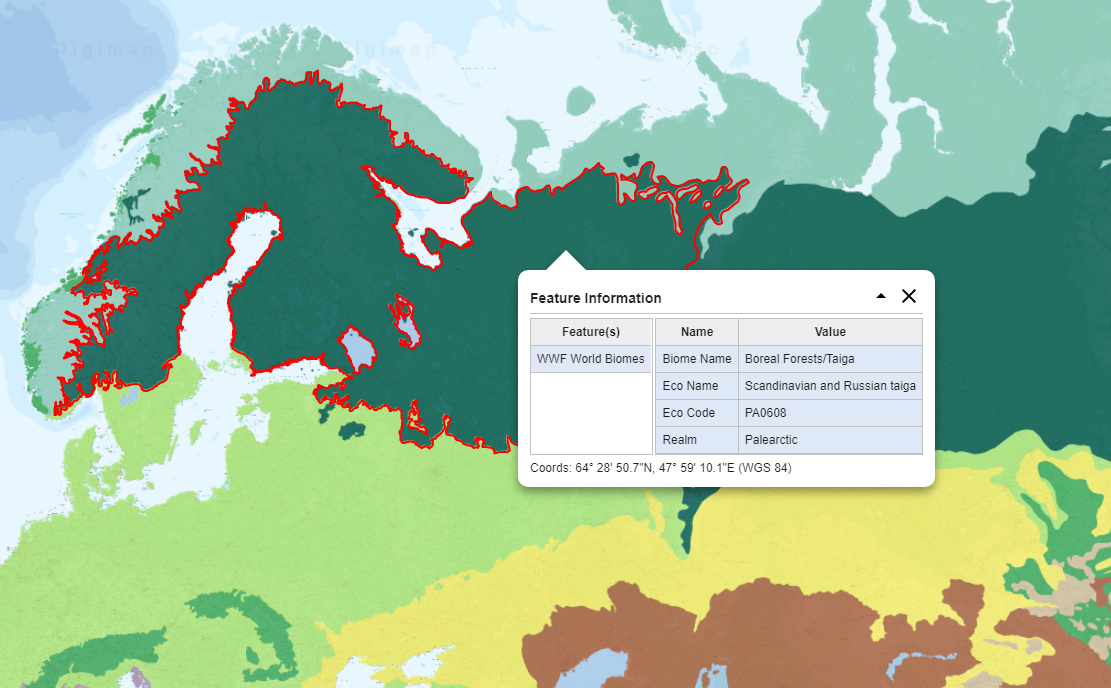
WWF World Biomes
- View the major ecosystems of the world.
- Use the Get Feature Information tool to identify regions, shown in the image below.

- Details of the data can be found in our guide.
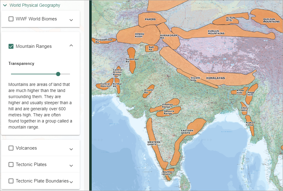
Mountain Ranges
- Labelled polygons indicate mountain ranges.
- NOTE: some labels may not be visible at every scale - you may need to zoom in/out to see labels for some ranges.
- Details of the data can be found in our guide.
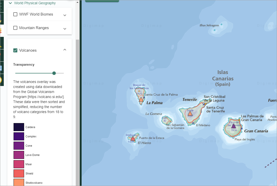
Volcanoes
- View volcanoes from the Volcanoes of the World database.
- Use the Get Feature Information tool to identify details of volcanoes, shown in the image below.
- Details of the data can be found in our guide.
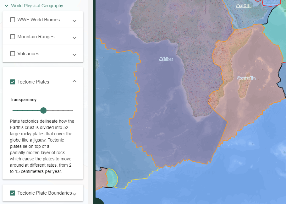
Tectonic Plates and Plate Boundaries
- View tectonic plates (with names), plate boundaries or both.
- Details of the data can be found in our guide.
Reference Grids
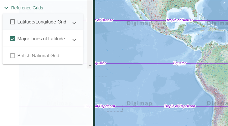
Major lines of latitude
Display the following lines on world maps:
- Arctic Circle
- Tropic of Cancer
- Equator
- Tropic of Capricorn
- Antarctic Circle
Latitude/Longitude Grid
Display a latitude/longitude grid on world maps.