User manual
-
Key areas of Digimap for Schools
-
About the maps
-
Navigating in Digimap for Schools
-
Search
-
Map selector
-
View the compass
-
Save maps
- Drawing Tools
-
View Geograph images
-
View map keys
-
Overlays
-
Measure distance and areas
-
Capture geographic coordinates
-
Add your own data
-
Print maps
-
Map information
-
Edit your preferences
-
Tips and tricks
-
Try it out!
Search
Search box
Find the search box on the top toolbar, on the left.

Search options
You can search for a location in Digimap for Schools using:
- place names
- GB postcodes
- British National Grid references
- easting/northing
- latitude/longitude
Place names
- Type the place name, e.g. London, in the search box.
- Select the magnifying glass button.
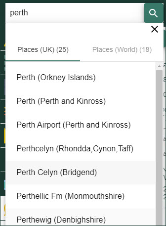
- If there is more than one match for your place name, the search results will be displayed below the search box.
- Select a place name from the results list(s). Note that place name results are separated into 2 lists; Places (UK) and Places (World).
- A map is generated in the map window that centres on your chosen place name.

UK postcodes
- Type your postcode in the search box.
- You can input a full postcode e.g. SW1A 1AA
- You can input a partial postcode e.g. SW1A
- Partial postcodes (e.g. EH9) only work if they are the only term searched for, i.e. don’t try EH9, Edinburgh.
- Select the magnifying glass button.
- A map is generated in the map window that centres on your postcode.
British National Grid References
- Type the Grid Reference, e.g. TQ302794 in the search box.
- You can use:
- 4 figure grid references e.g. TQ37
- 6 figure grid references e.g. TQ30 79
- 8 figure grid references e.g. TQ 302 794
- 10 figure grid references e.g. TQ3027 7949
- 12 figure grid references e.g. TQ 30276 79499
- Select the magnifying glass button.
- Either:
- A map is generated in the map window that centres on your grid reference, or
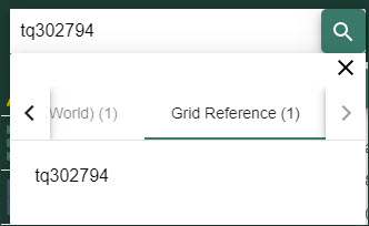
- You may have to select your grid reference from a results list. For example, in the image below, two types of result are given – place names and grid reference.

- Select the words Grid Reference, to view the results in that category.
- Select the correct grid reference from the list, to generate a map centred on the grid reference.
Easting/northing
- Enter your Easting/Northing as defined by coordinates on the British National Grid e.g. 545030 138305.
- Select the magnifying glass button.
- A map is generated in the map window that centres on your coordinates.
Latitude/Longitude
- Enter the coordinates in the search box.
- Acceptable formats are:
- Degrees, minutes, seconds (DDD° MM’ SS.S”) e.g: 55° 56’ 46.956” N 3° 9’ 45.588” W
- Degrees and Decimal Minutes (D°DM’) e.g.: 55° 56.7826’ N 3° 9.7598’ W
- Decimal Degrees (DD) e.g. 55.946377 N 3.162663 W or 55.946377 -3.162663
- you can use negative numbers for S and W values
- Note1: Coordinates can be entered with or without unit symbols.
- Note2: Coordinates can be entered with or without a comma between the values.
- Select the magnifying glass button.
- A map is generated in the map window that centres on your coordinates.
Watch the video
Check out the search options in our short video.


